-40%
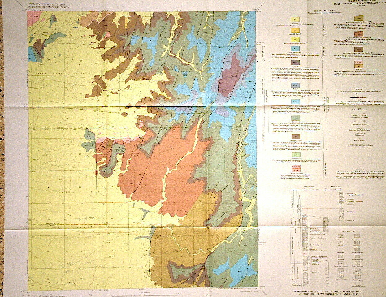
USGS GEOLOGIC MAP of MOUNT WASHINGTON QUADRANGLE New Mexico ALBUQUERQUE 1970
$ 6.28
- Description
- Size Guide
Description
SCARCE ITEM!! WON'T LAST!!This is USGS map GQ-886,
Geologic Map of the Mount Washington Quadrangle, Bernalillo and Valencia Counties, New Mexico
.” Published in 1970, there can’t be many of these around! This full color geologic map measures just over 32 inches wide and shows the geology of the area in detail. This is a 7.5 minute quadrangle map covering about 60 square miles.
Bedrock ranges from Precambrian to Permian in age and comprises igneous, metamorphic, and sedimentary rocks. There are granites, amphibolites, greenstones, rhyolites, and various others amongst the older rocks. The younger rocks are mostly sedimentary formations. There is locally noteworthy faulting in some areas.
It's a colorful, interesting map that details this mountainous area, part of which falls within the Sandia Military reservation, and part within the Cibola National Forest. A great map that will hold you interest as you consider the rocks of this area southeast of Albuquerque. Valencia County makes up the southern part of the map
Expert packing assured. The recent increase in postage rates was pretty big. As a result, Media Mail is now my default shipping method to keep shipping affordable.
Visit my store,
Rockwiler Books and Minerals.
I will continue to add items to my store, so check back frequently.
®
ROCKWILER
